Interactive geospatial platform developed for the Ministry of Agriculture of Honduras, giving users access to maps and data about agri-food sector production across the country. Built end-to-end from backend to frontend.
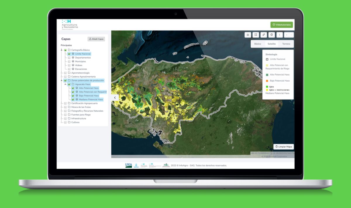
A production geospatial web platform developed for the Ministry of Agriculture and Livestock of Honduras (SAG), giving public users and analysts access to interactive maps and statistical data on agri-food sector production across the country. Built end-to-end as a freelance project, covering Django REST backend, ReactJS frontend with OpenLayers for cartographic rendering, PostgreSQL with PostGIS for spatial data, and AWS deployment. The platform integrates official agricultural datasets and renders them as interactive thematic maps, enabling users to filter by crop type, region, and production year. One of my first large-scale GIS projects for a government institution, and the foundation of my spatial data engineering experience.
